Trail Other activity Val de Bagnes - La Ruinette, 3875m - Photo
 asc
asc

User

© OpenStreetMap contributors
Length
Length
12.6 km
Max alt
Max alt
3833 m
Uphill gradient
Uphill gradient
2199 m
Km-Effort
Km-Effort  
35 km
Min alt
Min alt
1848 m
Downhill gradient
Downhill gradient
217 m
Boucle
Boucle
No
Creation date :
2014-12-11 00:00:00.0
Updated on :
2014-12-11 00:00:00.0

(0 Reviews)

Other activity
Other activity
--
Difficulty : Unknown

Scan this QR Code to open this trail in the SityTrail application

FREE GPS app for hiking

Logo SityTrail SityTrail

IGN / Geographical institutes

Download SityTrail from the App Store Download SityTrail from Google Play

Logo SityTrail SityTrail World

The world is yours!

Download SityTrail from the App Store Download SityTrail from Google Play Download SityTrail on Huawei AppGallery

About

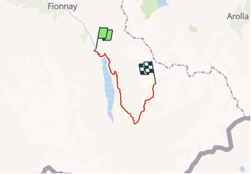
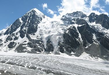
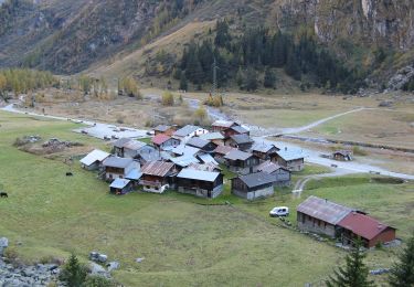
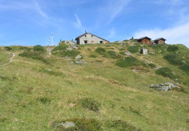
Trail Other activity of 12.6 km to be discovered at Valais/Wallis, Entremont, Val de Bagnes. This trail is proposed by asc.

Description

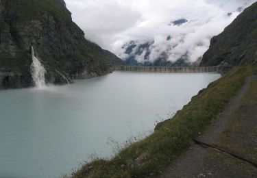
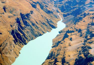
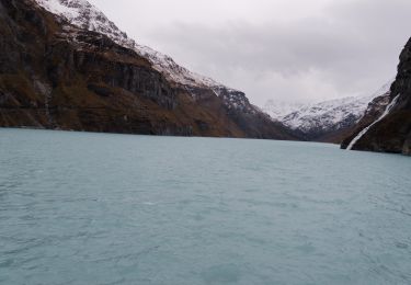
Ascension de la Ruinette par le col de la Lire, depuis le bas du barrage de Mauvoisin

Elevation profile

Positioning

Country:
Switzerland
Region :
Valais/Wallis
Department/Province :
Entremont
Municipality :
Val de Bagnes
Location:
Unknown
Start:(UTM)
371584 ; 5095648 (32T) N.

Trails nearby

Trail On foot Val de Bagnes - Barrage de Mauvoisin - Le Pleureur - Photo
On foot
PRO

On foot

Medium
Val de Bagnes, Valais/Wallis, Entremont, Switzerland
4.3 km | 23 km-effort
5h 11min
No
Trail On foot Val de Bagnes - Pazagnou-Col des Otanes - Photo
On foot
PRO

On foot

Easy
Val de Bagnes, Valais/Wallis, Entremont, Switzerland
4 km | 11.6 km-effort
2h 38min
No
Trail On foot Val de Bagnes - Fionnay-Bonatchiesse - Photo
On foot
PRO

On foot

Easy
Val de Bagnes, Valais/Wallis, Entremont, Switzerland
4.5 km | 6.3 km-effort
1h 26min
No
Trail On foot Val de Bagnes - Louvie-Fionnay - Photo
On foot
PRO

On foot

Easy
Val de Bagnes, Valais/Wallis, Entremont, Switzerland
3.7 km | 6.3 km-effort
1h 26min
No
Trail Walking Val de Bagnes - Mauvoisin Bonatchiesse - Photo
Walking
michauxpaul

Walking

Difficult
Val de Bagnes, Valais/Wallis, Entremont, Switzerland
8.7 km | 16.2 km-effort
3h 40min
Yes
Trail On foot Val de Bagnes - Panossière-La Maye - Photo
On foot
PRO

On foot

Easy
Val de Bagnes, Valais/Wallis, Entremont, Switzerland
3.8 km | 6.4 km-effort
1h 27min
No
Trail On foot Val de Bagnes - Bonatchiesse-Mauvoisin - Photo
On foot
PRO

On foot

Easy
Val de Bagnes, Valais/Wallis, Entremont, Switzerland
3.2 km | 6.1 km-effort
1h 22min
No
Trail On foot Val de Bagnes - Tour du Val de Bagnes - Photo
On foot
PRO

On foot

Very difficult
Val de Bagnes, Valais/Wallis, Entremont, Switzerland
36 km | 72 km-effort
16h 15min
No
Trail Walking Val de Bagnes - CHX ZRMT Étape 4 de Cabane de Louvie à Cabane de Prafleuri - Photo
Walking
jeff2

Walking

Medium
Val de Bagnes, Valais/Wallis, Entremont, Switzerland
12.3 km | 25 km-effort
5h 28min
No


Close
My subscriptions